A selection of surveying, aerial mapping, terrain modelling and geospatial projects undertaken by PASCO Thailand.
OUR PROJECTS
Projects delivered by PASCO Thailand
Browse our selected projects, including technical information and original project images.
DTM AND ORTHOPHOTO MAPPING OF RAYONG
◉ Rayong, Bangkok◷ 2013
Project Summary
Orthophoto Mapping
Description
Aerial Triangulation, DTM 40 meter and Digital Orthophoto resolution 30 cm. and GIS feature layer cover area 288 km2
Sensor
DMC-1
Detail
Scale of Orthophoto Mapping 1 : 4,000
STREET TREE SURVEY PROJECT
◉ Japan◷ 2012
Project Summary
Street Tree Data Collection with PPS.
Description
The survey project requires height, perimeters, area information and kind. Surveyor will perform field survey for the detail of trees along each route.
Sensor
Lady Bug 360 Panorama
Detail
Final, Creation of Video Data, Survey Map and Inventory
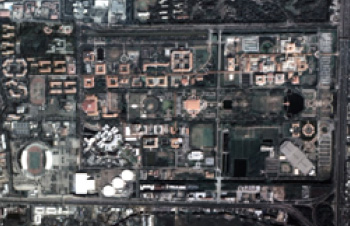
DTM AND ORTHOPHOTO MAPPING OF THAMMASART UNIVERSITY
◉ Pathumthani, Bangkok◷ 2012
Project Summary
Orthophoto Mapping for analyzed and planned flood protection.
Description
Aerial Triangulation, DTM 40 meter and Digital Orthophoto resolution 30 cm. and GIS feature layer cover area 4 km2
Sensor
DMC-1
Detail
Scale of Orthophoto Mapping 1 : 4,000
CHAO PHRAYA RIVER BASIN FLOOD CONTROL PROJECT
◉ Thailand◷ 2011-2012
Project Summary
Chao Phraya River Basin Flood Control Project Lidar Survey and Orthophoto Mapping.
Description
Airborne Laser Scanning and Orthophoto data creation area of Chao Phraya River Basin Flooded Region: 24,590 km2
Sensor
ALS50-II, 60, 60II and RCD 105
Detail
Orthophoto GSD 0.5 m., Lidar data resolution interval is 2 m.
PREPARATION OF ORTHOPHOTOS SCALE 1:10,000 IN THE REPUBLIC OF CAMEROON
◉ Cameroon◷ 2011
Project Summary
Aerial Triangulation, DTM 100 meter and Digital Orthophoto resolution 50 cm.
Description
Cover area 6,912 km2 in Cameroon
Sensor
UltraCam X
Detail
Scale of Aerial photos 1/25,000
Ministry of lands, forestry & mines Ghahna land administration project the republic of Ghana
◉ The republic of Ghana◷ 2009
Project Summary
Scanning film, aerial triangulation, DTM, Digital Ortho photo and Contour 2 meter
Description
Cover 15,070 km2 of Ghana
Sensor
RC 30 and IMAO DIGICAM 39H
Detail
Total 13,286 aerial photos
DIGITAL TERRAIN MODEL MAP OF NETHERLAND
◉ Netherland◷ 2009
Project Summary
DTMaster program for correctly modify DTM
Description
Digital Terrain Model Map cover Area 41,500 km2 all of Netherland
Sensor
Lidar
Detail
DTM interval 5 meters.
Engineer mapping and surveying services in Singapore
◉ Singapore◷ 2008
Project Summary
Ortho photo project of US base camp in Singapore
Description
Making Digital Ortho photography of Singapore
Sensor
UltraCAM-D
Detail
Ortho Photo 5cm GSD
Photogrammetric Restitution, Orthophotographs, Maps and Digital Vector OrthophotoMaps in the republic of Panama
◉ PANAMA◷ 2007-2008
Project Summary
Stereo Plotting and Ortho photo project of PANAMA
Description
Making Digital Ortho photography of 2,600 km2 of PANAMA and cadastral topographical maps 417 km2.
Sensor
UltraCAM-D
Detail
RGB Ortho Photo 20cm GSD, Digital Topographical maps 1/1,000 scale
Aerial Orthophoto Mapping (Old photography) Kanchanaburi and Roi Ed (Forest Area) 1:4000
◉ Thailand◷ 2007-2008
Project Summary
Ortho photo project of Thailand
Description
Black & White Ortho Photo of 2 Are as, 2terms
Sensor
Many old film camera
Detail
Ortho Photo 30cm and 75cm GSD
Survey of Mangrove boundary and Standard Mapping in Trad Province
◉ Thailand◷ 2007-2008
Project Summary
to survey or mangrove boundary, preparing database and GIS and to print a standard Map 1:4,000 and 1:50,000
Description
882 Sq.Km Physical survey and Mapping, GIS and laser survey
Sensor
MOAC aerial photograhpy
Detail
1:4,000 Mapping and GIS database
Film Duplicate Pilot Project
◉ Thailand◷ 2007-2008
Project Summary
to duplicate an old film (50 years ago) and scanning
Description
34 Film rolls has been duplicated
Sensor
Duplicate Film and to scan as digital image
Detail
1:4,000 Mapping and GIS database
Topographical map 1/50,000 in Georgia
◉ Georgia◷ 2006-2007
Project Summary
Stereo plotting project of Georgia
Sensor
Film Camera
Detail
Digital topographical maps 1/50,000 scale
CCDP_OP / Digital Orthophoto Procurement - CCDP-03-02
◉ Cambodia◷ 2006
Project Summary
Ortho photo product over an area of approximately 62,000 sq km in Western and Northern Cambodia
Description
Black & White Ortho Photo
Sensor
RC30
Detail
Ortho Photo 50cm GSD
PREPARATION OF ORTHOPHOTOS SCALE 1:1,000, OF SAN PEDRO SULA URBAN AREA, 290 KM 2 DEPARTMENT OF CORTES, REPUBLIC OF HONDURAS
◉ Honduras◷ 2006
Project Summary
Ortho photo project of San Pedro Sula city in Honduras
Description
Making Ortho photo products by Scanning Aerial film
Sensor
Film Camera
Detail
RGB Ortho Photo 10cm GSD
Procurement of Digital Images on a 1:20,000 scale (resolution 0.40 m) and Preparation of Orthophoto (resolution 0.50 m) of the Republic of Guatemala
◉ Guatemala◷ 2005-2006
Project Summary
Ortho photo project of Guatemala
Description
Digital Ortho photography of 108,900km2 of GUATEMALA
Nakhonnayok Laser survey and Orthophoto Mapping (SatelliteCity) Project
◉ Thailand◷ 2005-2006
Project Summary
Physical survey, GIS, Lidar survey and orthophoto Mapping
Description
882 Sq.Km Physical survey and Mapping, GIS and laser survey
Sensor
MOAC aerial photography and ALS50 (for laser survey)
Detail
1:4,000 Mapping and GIS database
Cadastral Survey and Land Registration Project, MON-1736/IS-APDOP-05/01
◉ Mongolia◷ 2005
Project Summary
Ortho photo project of Mongolia
Description
Making Digital Ortho photography of 5 cities in Mongolia
Sensor
RC-20
Detail
Ortho Photo 15cm GSD
This website uses cookies that provide necessary site functionality and improve your online experience.
You can set your browser settings to refuse that we use cookies.
However, if you reject cookies you may not be able to use a part of this website.